Wednesday, March 31, 2010

French Quarter, New Orleans


We are now in New Orleans for the next few days. Our first stop in the French Quarters was Cafe du Monde for our warm Beignets and Cafe Au Lait, a New Orleans tradition since 1862. And the fried, confectioners' sugar-dusted doughnuts didn't disappoint us! One suggestion....don't wear black!
The historic center of the city is Jackson Square, unofficially the Quarter's Left Bank. This area attracts crowds due to the sidewalk artists, palm readers and street performers. Facing Jackson Square is St.Louis Cathedral, one of the oldest and most photographed churches in the country.


All parts of this city were hit hard by hurricane Katrina in 2005 by force winds and rain, but it was the flooding from the levee breaches that caused catastrophic damage. The city already lies 6-feet below sea level and when this system failed, 80 percent of the city was under water. The French Quarters saw minimal damage because it is on higher ground. The Bourbon Street area is run down, but it has always looked that way. We love the wrought-iron balconies, wraparound porches, French windows and hidden courtyards so famous in this area. Coming into the city, we did see areas where there is still damaged neighborhoods and smaller business boarded up and vacant lots for sale. It is amazing there is still trace of the devastation after all these years.
It is interesting that New Orleans is 100 miles from the ocean, but it is surrounded by water; Lake Pontchartrain and the mighty Mississippi River. The city has endured many storms and fires, but continues to survive. The Big Easy and unofficial motto, Laissez les bons temps rouler ("Let the good times roll") say it all down here.
We will be back tomorrow for more walking around the garden district, St. Charles streetcar, and visit some cemeteries.

Sunday, March 28, 2010

Fort Worth Stockyards, Texas


The stockyards in Fort Worth, Texas was once the largest livestock marketing center in the Southwest. Wranglers on horseback demonstrate a cattle drive down the center of town daily, as visitors watch. This was a place to experience true Western heritage. They have a real rodeo (during season), vintage 1896 train rides, live country music, cold beer at authentic saloons, and two-stepping in the world's largest honky tonk, Billy Bob's Texas. Andy and I once took a mini-class in two-stepping when we were in Nashville...neither one of us remember any steps, so we stayed clear of all honky tonks!
They have the cutest longhorns! This one steer in particular loved Andy and kept following him along the fence. Probably because Andy was scratching his horns. The rest of the steers were just sunning themselves and paid no attention to our presence.


Dealey Plaza, Dallas Texas


We spent over three hours tracing the motorcade route of JFK and explored the site of his assassination at Dealey Plaza and the former Texas School Book Depository in downtown Dallas, which is now The Sixth Floor Museum at Dealey Plaza. This educational exhibition on the life, death and legacy of President John F. Kennedy featured photographs, artifacts, films, and the spot on the sixth floor where Lee Harvey Oswald fired at the motorcade. There is an "X" marked on the street where JFK's car was when that fatal shot occurred and there is Andy standing in the street to see if indeed the window is in view. The window is on the second level from the top, corner one on the right side of the building. The picture taken of us is on the "grassy knoll", where it was reported that a second gunman fired a shot.
The odd picture of the white "monument" is the JFK Memorial designed as an open tomb, so visitors can "reflect and find their own spiritual meanings", according to the renowned architect Philip Johnson.
We were impressed with Dallas. It was clean, friendly, and a great skyline of progressive architectural buildings, along with historic districts that were well preserved.


Friday, March 26, 2010

Palo Duro Canyon State Park, Texas


We arrived in the Panhandle of Texas, just outside the city of Amarillo. This name means "yellow" in Spanish, likely came from the gold colored soil and the wildflowers that thrive in season...though, no wildflowers while we are here!
Just before arriving in town, there is Cadillac Ranch, owned by Amarillo's millionaire art fancier Stanley Marsh III, who is known for his patronage of the pop-art movement of the late 1960s and early 1970s. In this field, there are 10 vintage Cadillacs half-buried nose-down. The cars are painted with graffiti. This roadside masterpiece is called "Hood Ornament of Route 66". I wanted to walk out there to take better close-up pictures, but the mud was soooo muddy-thick and slippery. I tried to walk there but sunk in the mud over the top of my shoes. One step my shoe actually stuck like a suction cup and my foot came right out of my shoe! I don't even think my mudding boots would have helped get me there. So, I took my pictures from the road. It was quite a site! And my leather Clarks are still being cleaned.
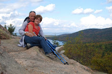
We spent the night in Palo Duro Canyon State Park, just south of Amarillo. This state park is very large and as you arrive into the park, you drive 2 miles at a 10% grade down to the canyon floor, where the park actually is located 1,000 feet below the rim. They have many hiking and mountain bike trails and three campgrounds. Nice location. And we met many nice couples traveling the country just as we are. One couple from Maryland just got on the road within the last week and are traveling up to Alaska. They had many questions for us and of course, we had much advice to give. They actually took this picture of us after we climbed to the cave.
Of all the traveling we have done through out Texas, we have not seen any Texas Longhorns until this state park. Take a look at those long horns on their heads!!


Route 66


"If you ever plan to motor west.
Travel my way, the highway that's the best. Get you kicks on Route 66!"
The Mother Road or Main Street of America....now it is called Historic Route 66, and I-40 travels most of it. This 2-lane road connected Los Angeles to Chicago, over two thousand miles all the way. We have been following it through Flagstaff, Albuquerque, Santa Fe, Santa Rosa, Tucumcari, and Amarillo. We have seen great displays of neon signs, rusty middle-of-nowhere truck stops and run down motels. Much of the landmarks have not been renovated and still display the charm of the era they were built. Much of the highway was essentially flat, making it a popular truck route. It also passed through many small towns, helping to create the rise of mom-and-pop businesses. It was originally gravel or graded dirt, but became the first highway to be completely paved in 1938. With the building of the Interstate, like I-40, many of these small towns could not thrive once the traffic was diverted.
We actually spent the night in Tucumcari and drove through the town on Route 66. This town worked out a deal with the state and federal government in determining the I-40 bypass to be as close to their business area to permit easy access to the localities. Tucumcari has a lot of the original buildings and signs. It is not built up or modernized, just an old town which makes you feel you're back in the 1950's, driving a back street highway.


Tuesday, March 23, 2010

Albuquerque, New Mexico

Albuquerque had many sites for us to see. They are famous for their International Balloon Fiesta, held every early October. It is the biggest and best gathering of balloons anywhere on this planet. During this time, the clear desert skies are painted with a kaleidoscope of color as hundreds of balloons lift off. Because of Albuquerque's location, high Sandia Mountains in the east and ancient volcanic cones to the west, this creates an effect called the "box", where wind currents allow pilots to fly in any direction. The high-altitude desert location also gives it endless blue skies and great visibility. Although, we did not see any hot air balloons flying in the air, we did visit the Balloon Museum and saw the collections and programs highlighting the art, history and sport of ballooning. Andy even tried to land a balloon in a simulator, but unfortunately, he crashed! Two Albuquerque-native balloonists, were the first to cross the Atlantic Ocean in a gas balloon in 1978.
We also went to the Petroglyph National Monument, where there were opportunities for viewing petroglyphs (images created on rock) by hiking on some trails. This park is one of the largest petroglyph sites in North America with over 20,000 designs and symbols carved onto black volcanic boulders about 400-700 years ago. Some of these images are recognizable as animals, people, and crosses. Other images are mysterious. To the American Indians, this entire site is a sacred landscape.
After lunch, we walked the streets of Old Town Albuquerque, the city's original settlement founded in 1706. There are great shopping and galleries in Old Town Plaza, just like Santa Fe. It follows the traditional Spanish pattern of a central plaza and church surrounded by homes and businesses. The difference is there is a mix of Victorian and basic adobe architecture here. Andy and I did some shopping, and actually bought some souvenirs! Another great day!


Monday, March 22, 2010

Santa Fe, New Mexico


Most experts agree that Santa Fe was once the site of Pueblo Indian Villages that seem to have been abandoned centuries before the Spanish arrived in 1607. The colonists used the Indian method of adobe construction, produced by combining sand, clay, water and fibrous organic matter like sticks or straw. The modern day Santa Fe has retained this Spanish-Pueblo look. As a matter of fact, strict ordinances enacted decades ago, mandate this appearance of all new buildings. Even fast food restaurants and convenience stores conform to the traditional adobe style. We visited the 1610 San Miguel Mission Church, claiming to be the oldest church in the USA. It serves as a shrine to St. Michael and Mass is celebrated here weekly.
We also spent time in the Plaza, the core of the original settlement, which remains essentially intact for nearly 4 centuries. The Plaza is a square block which is a vital center of commerce, festivals and history. The sidewalks along the square have local Indian arts, crafts and jewelry on display for purchase. The locals sit right on the pavement with their items spread out on blankets right in front of them. The prices do not seem to be negotiable, they are what they are!
The city is full of museums and many art galleries. Artists have been drawn to this area because of its beautiful scenery and southwestern sunlight. We did have great weather today for our walk around the city, blue sky, hot sun with 72 degree temperatures. It is a clean city and appears much smaller then the 62,000 plus residents. Narrow streets, old buildings and many up-scale shops and restaurants. We could live here....but another winter storm is on its way. And we did see some small piles of snow in shady areas.


Saturday, March 20, 2010

Finding Something to Do in Aztec, New Mexico

Stopped in Aztec on our way down to Albuquerque. This area has been hit with cold and snow (AGAIN!). They have even decided to keep the ski runs open longer due to the 8-14 inches of fresh snow in the higher elevations. That cold front should be out in the next day, so we stayed in this area after seeing the Aztec Ruins. Both I-40 and I-25 were closed due to ice and snow; we couldn't have gotten very far anyway.
We had read in The Official Aztec Visitor Guide that "the natural wonders surrounding Aztec provided inspiration to the spirit and an appreciation of the artistic side of nature's creations". Sounding entertaining, we ventured out to see for ourselves. There are several Arches in the area, only problem, the visitor center was closed (it is Saturday) and the local police never heard of these Arches! Turns out only a few local residents have ever explored and documented these sandstone tributes. We had sketchy written directions and Garmen...how hard could they be to find! The directions said "drive NM 173 for 5.6 miles, then turn right on dirt road. Travel 0.5 miles and park at oil well. Walking distance from oil well is 100 yards northeast for one and 200 yards south for the second one, and under 1/3 mile southwest is the last one." That was it!
Andy and I found two of them! Walked a while and never found the last one. But it was nothing compared to the other Arches we saw up in Utah. Although, Andy had fun climbing, and me, taking pictures. Anyway, it killed part of our afternoon.
On our way back to town, we drove past a Motor-cross track and stop to watch the bikers. Looked like fun, but dangerous. Would like to see a race.


Aztec Ruins, New Mexico


The Aztec Ruins National Monument is one of the largest and best preserved Ancestral Pueblo ruins, built around 1110. It is not built by the Aztec Indians of central America, as the name may imply. Anglo settlers named the place Aztec, thinking it was Cortez's conquest of Mexico.
It contains nearly 450 rooms, some which remain intact. It stands three stories tall and 900-year old roof timbers cover rooms with intact plaster. The first builders layed-out a great master plan as a settlement. It is believed that these were public buildings, civic centers or places of worship for their community. We were impressed with the size of this place. One wall is 800-yards long and the ruins are wider than a football field. Also amazing, the National Park allows you to explore some of the dark chambers, with the timber roof still intacted.